MISSION EDITOR

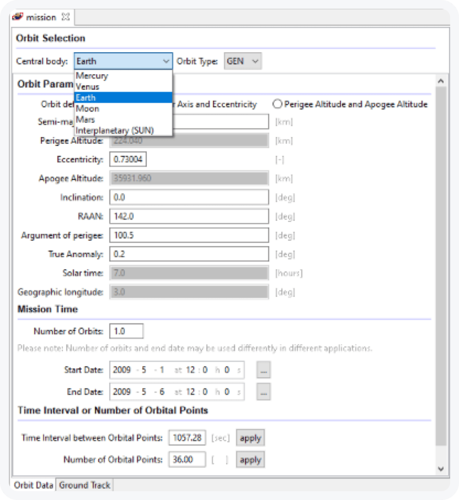
The left side of the “Orbit Data” page of the mission editor (s. screenshot below) allows to specify all necessary parameters to define the orbit or trajectory (interplanetary) and a mission, and the number of orbital points that should be analysed by ESABASE2/Debris.

Mission editor image example

To specify the orbit the user can choose between the central bodies Mercury, Venus, Earth, Moon, and Mars, as well as “Interplanetary (SUN)” mode for interplanetary trajectories that are handled via SPICE. For the Earth, the user can choose between a predefined geostationary orbit (GEO) and a predefined sun-synchronous orbit (SSO), or he can specify the orbit by entering its orbital parameters manually. The latter option can be applied to all central bodies.

Instead of specifying the semi-major axis and the eccentricity the user can input the apogee and the perigee altitudes.

To complete the input of the mission file the user must specify the mission start and end time and the analysis time interval. ESABASE2 performs the analyses at dedicated orbital points. The user can either input the time interval between the orbital points or the number of orbital points.

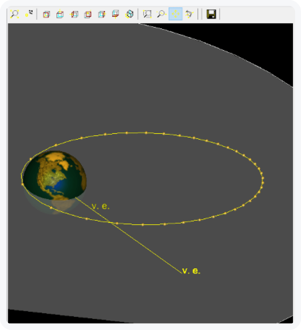
The mission visualisation on the right side of the “Orbit Data” page of the mission editor enables a quick view of the specified orbit. Currently, the visualisation is available only for Earth as central body.

Mission visualisation

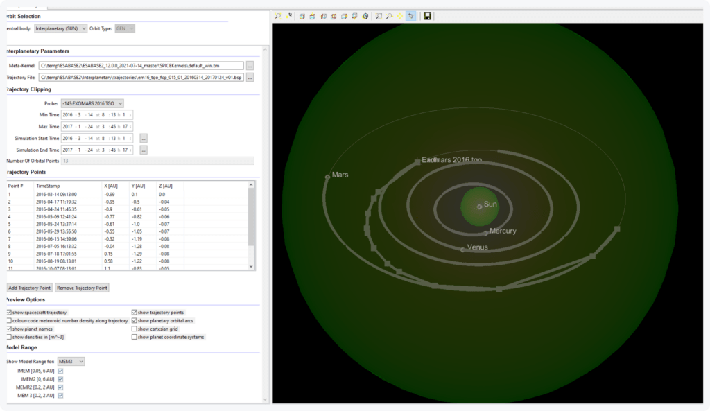
The “Orbit Data” page of the mission editor is structured the same way for the interplanetary mode, i.e. “Interplanetary (SUN)”, see next figure. It provides on the left side the possibilities to configure the trajectory and the mission and a visualisation on the right side.

Interplanetary mode image

The trajectory for the interplanetary mode can be provided via SPICE (or OEM that is converted to SPICE kernel). Two kernels are required: the probe trajectory kernel and a Meta-Kernel, which includes all other relevant SPICE data, e.g. for planets, objects to be pointed at, etc. A user-defined Meta-Kernel is possible. A mission can be defined within the time frame of the loaded trajectory. A stepping algorithm, that is based on spatial density, defines a list of orbital points to be analysed. The list can be adapted by the user by adding or removing orbital points.

The mission ground track page of the mission editor enables a quick view of the ground track of the specified orbit. Currently, the ground track visualisation is available only for Earth orbits.
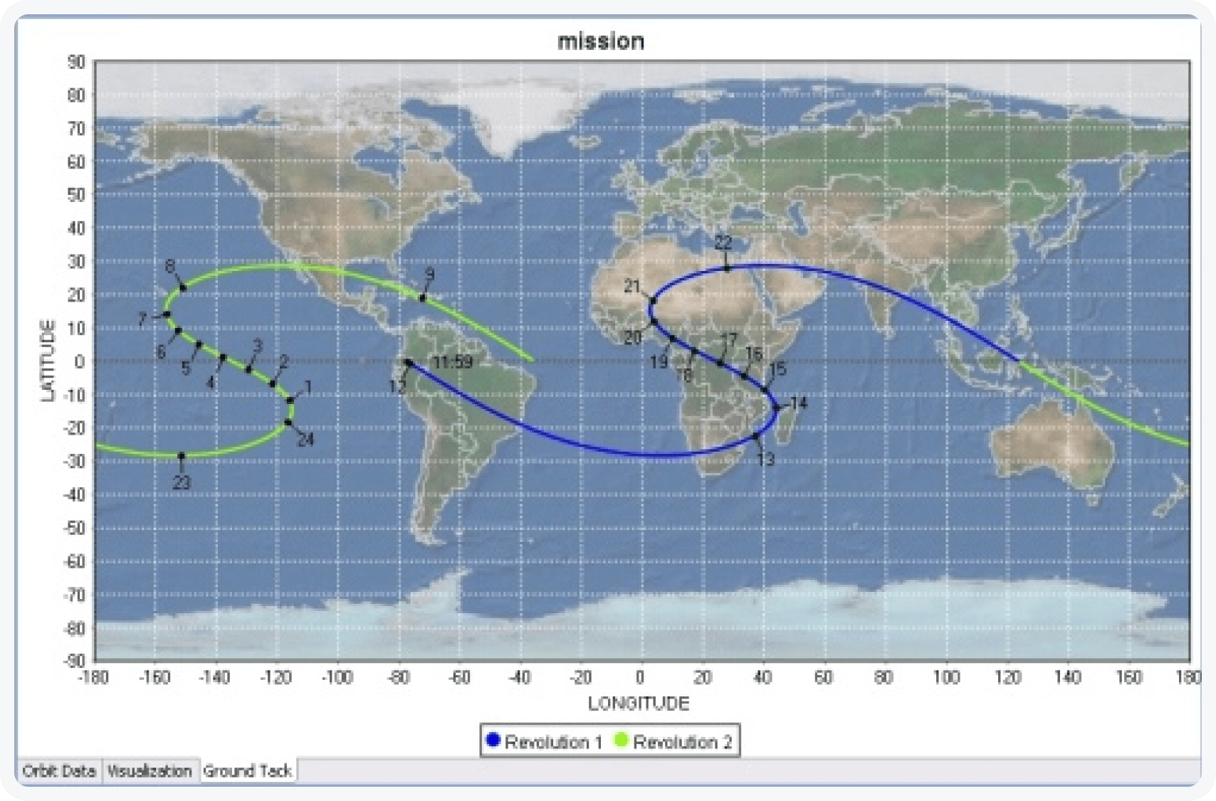
Mission ground track